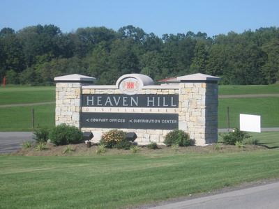
Several things have happened today that suggest whatever I'm doing with this navigation and pedalling stuff, I'm headed in the right direction. For starters, the lat / long numbers are looking good. I've dropped a litle below 38N, but that's OK, it gets me into southwest Virginia, then I'll repair the damage by riding up the Valley. I need to work on the longitude numbers, but I've planned for that in the days ahead. Another thing that's happened is I've returned to the Eastern time zone. I haven't been changing the clocks as I go (life's too short), so now the GPS and CatEye both read the correct time. Another thing, I'm camping on a Saturday night in a place where I can pick up Garrison Keohler (I know that's not spelled right) on NPR. And they sell beer in Bardstown, Kentucky. There's a huge distillery right on the outskirts of town. Kentucky is a many-faced place.
Today's ride was a rider's ride. As my cycling friends in Charlottesville get ready to go to Waynesboro and ride a century in the Shenandoah Valley tomorrow (sorry folks, I'm going to have to pass on that one this year), I've just ridden a ride that's about as good. Probably stacks up as one of the best riding days of the trip.
 terbaccer ready for cuttin'
After being kept up half the night by wild antics on the part of my fellow campers, I was only too happy to pack up and leave at first light, but I was bleary from sleep deficit. I had to make some miles today, there are not a lot of camping opportunities in these parts. It's not as easy to go off into the bush and camp as it was out west.
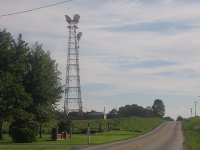
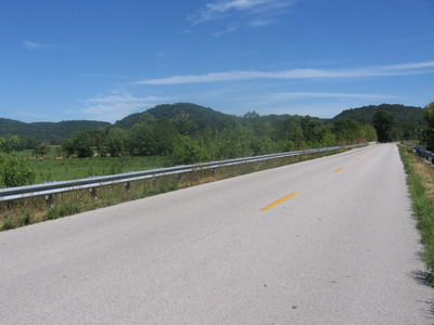
Rough River Reservoir is on a sandstone upland, the roads east stay high for the first ten miles or so. When you're riding by microwave towers, it's a good indication that you're on a topographic high. The views were not spectacular as from the Virginia Blue Ridge, just more rolling countryside off into the horizon.
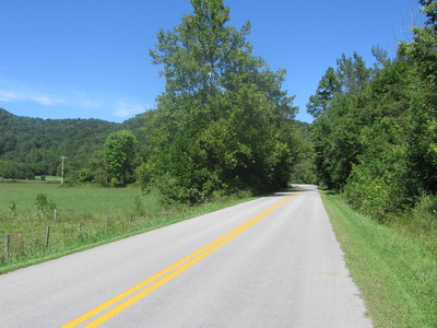
At Hudson I stopped at the store & chatted with the owner over Gatorade. He's out of gas, and the next delivery is going to be expensive. Leaving Hudson, I turned south on RT 84 and things immediately got interesting. This is a well paved, narrow, gnarly little country road that winds around and up and down through small farms, great motorcycle or bicycle road. So I'm cruising along, in the groove, and all of a sudden there's one of these steep downhill warning signs, and the thing just turns into a cliff, diving down to cross the Rough River!
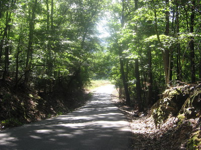
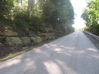
Quartzite looking ledges are horizontal but the road is just short of jumping down from ledge to ledge. I'm riding both brakes, glad I'm not going the other way, wondering what lies ahead. That's got to be the steepest grade I've ridden so far on this trip. The climb up out of the gorge on the other side of the Rough was not as steep, I got the good end of that deal.
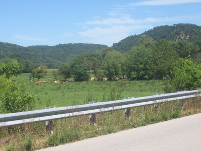
Another 15 miles or so riding the uplands, there's another great descent into the Nolin River valley. The Nolin runs on carbonate rocks, lower stratigraphically and elevation-wise than the clastic rocks to the west. This is just north of Mammoth Cave National Park. The road continues winding around for 30 miles or so through karst limestone country, lots of sinkholes.
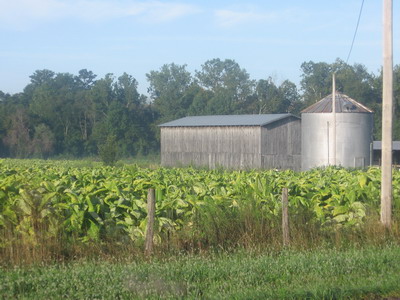
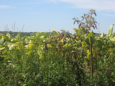
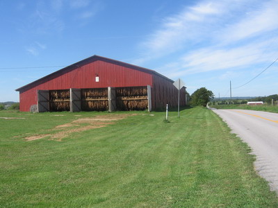
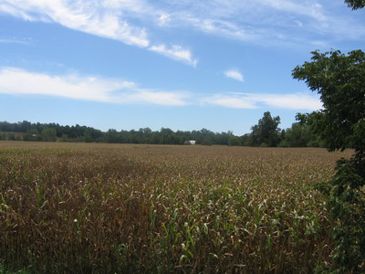
There's tobacco growing in fields and curing in open barns. It's part of the ambient scent. I do some photos.
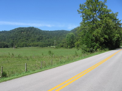
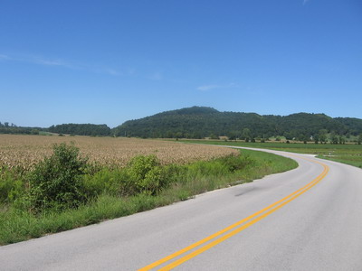
At my meal fest in Sonora at a restaurant at the I65 interchange, everybody was smoking. Waitresses, customers, everybody. People were smoking cigarettes while they ate their food. The smoker index seems higher than in other places I've been on this trip. Reminds me of travelling through Piedmont North Carolina, where it's seems like it's a civic responsibility to smoke in order to shore up the local economy. Just when things were getting a little ho-hum, there's a spectacular descent to the Rolling Fork of some river not named on my maps, I'll figure it out when I get home. It was with some trepidation that I crossed the bridge, having just descended 400 feet or so, wondering how steep the ascent was going to be. But no, it opened up into a spectacular valley of farmland bordered by forested ridges.
The river crossing is the county line between Larue and Nelson Counties....there's beer in Nelson! Right over the bridge there's a bar serving the needs of untold miles of thirsty folks to the west.
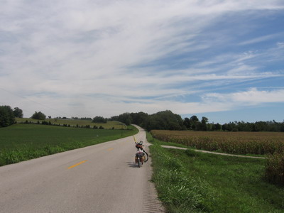
The road winds around the rim of the flat flood plain, brown corn ready to be cut, green forested hills border the valley. Occasional cuts are black shale. In Virginia this stuff would be Devonian, but it seems to be below the carbonates. I'm lost in the stratigraphy.
 This is a black shale valley
Another series of ascents, then a screamer descent which I figured would take me into Bardstown. Noooooo, within the last 3 miles I had to climb all the way out of the river valley, then go down and back up again! It was a killer. They don't do that to you when you come back into Waynesboro after the Valley ride.
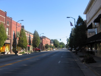
But the campground was right there, and the showers are strong. My Old Kentucky Home State Park, honoring Stephen Foster.
 in the midst of all these dry counties...
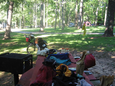
There's outdoor theater in the park, but it's shut down for the season. This park doesn't have quite the same craziness as last night's fare. There's no lake.