Atchison, Kansas was a very watery place during my brief visit. It rained several inches during the evening. The parking lot was flooded by the time I finished dinner & waded back to my motel room. It also rained in my room overnight due to a leaking pipe upstairs, and a plugged air conditioner drain drooled water onto the carpet. The tub didn't want to drain. Clearly it was time to seek higher ground.
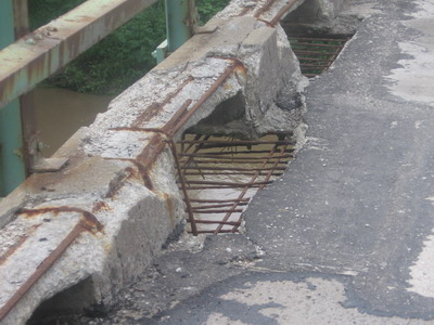
The bridge carrying US59 over the Missouri River is an aging narrow affair, with a steel grate deck that was filled with concrete sometime in the distant past.
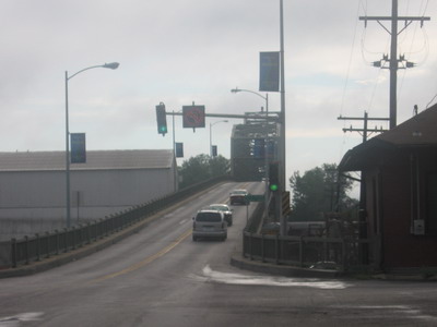
It was wet like most things this morning at 8AM and slippery; I took the whole lane and picked my way across as a line of traffic crawled behind me. There was a guy on a farm tractor going the other way with his line of traffic crawling behind him. Everybody except me got a good chance to look at the river. And no, I didn't stop in the middle to take a picture.
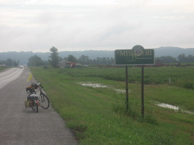
After the bridge, there was about a 15 mile run along the flood plain.
There was high water last night in a lot of the fields along the road, and there was carnage in the form of dead frogs and snakes. I guess these guys had come up onto the road in order to get out of the flood. I haven't written about roadkill, but it's certainly part of the touring cycling ambiance. I've been amazed at the number of dead songbirds I've seen on this trip, in all geographic areas I've been through. What is it with songbirds and highways?
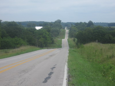
As I rolled across the flat flood plain I knew the party would soon end. Sure enough, before the town of Weston I got involved with what makes Missouri infamous among touring cyclists....hills, lots of hills, steep hills, lots of winding up-and-down, all within a few hundred feet of topographic relief. There are no high mountains here, or at least in this part of the state.
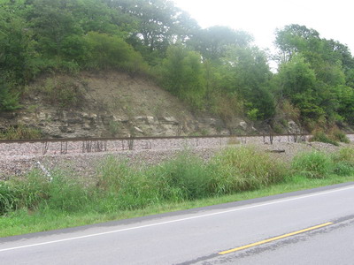
It's fascinating how different the landscape is in western Missouri from, say, eastern Nebraska or eastern Kansas. For one thing, there is solid rock close to the surface in Missouri, flat-lying beds of sandstone, limestone and shale. The stream drainages are in a sort of dendritic pattern, which gives pretty much a random orientation for hills and valleys.
A lot of the roads cut straight across the countryside. If there's a hill, well hell fire, run that sucker up the hill. None of this namby pamby cut and fill stuff, just run it over the hill, down into the valley, and over the next hill.
Other roads have a lot of curves, but the curves don't have any particular sense of purpose in terms of working with the topography, national security, or just plain getting from A to B.
A lot of the roads have letter designations. I was on a curvey road called "W" for a while today. I guess we're all on a curvey road called "W" for the next few years.
I'm riding along a flat river bottom, cross a bridge,
bam, there's a cliff to climb with a grade steeper than anything you'll find in Virginia.
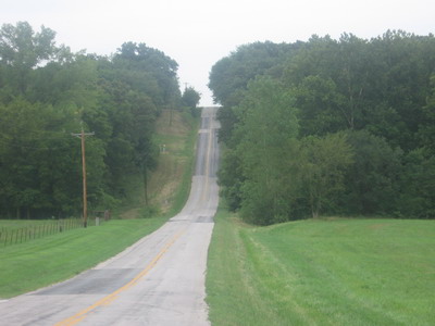
From a distance some of these things look ridiculous, crazy steep, almost vertical. And they are. I double-clutch, slam it into something in the basement of my collection of gears & grind up he hill. Hey, I'm a truck driver. The hills are short lived, otherwise there'd be mountains, and there's usually some kind of screamer down-hill on the other side. There are times when the wavelength and amplitude of the rolls is such that the momentum on the downhill about carries me up the next up.
I'm actually enjoying the ride. As those who ride with me know, climbing hills is my thing. However demented that may sound. The route takes me through countryside where farm land and woodland is being converted to housing developments serving greater Kansas City. It's borderline suburbia. There's an increase in incidents of dog mania as I pass by, but so far all have been contained by fences. Also an increase in "no trespassing" and "keep out" signs along the road.
I pass quite a few recreational cyclists going the other way on their Saturday ride. The weather is overcast and not hot. There are lots of hardwood trees, sounds of tree frogs, sounds of people cutting their grass. The wind may be blowing up above for all I know, but the trees and topography have it effectively scotched at ground level.
At Holt I stop at the only place to stop, eat some food, and hang out for a while. I'm only a few miles out from the night's stopping point. I really enjoyed my visit to Holt. While I ate my sandwich I chatted at length with one local who's a cyclist, we looked at maps, talked about routes. I bought 44 cents worth of premium gas for my camp stove (that's always a conversation starter), then I chatted with the cycling youth of Holt. The kids were fascinated with my rig. And the notion that I had somehow ridden to their town all the way from Oregon.
I rode out of Holt onto the most twisty, up-and-down, demented collection of roads of the day. I think today is the day when several of my buddies are out there doing the Extreme Sports (Death Ride) century down and up and down and up the Virginia Blue Ridge for 100 miles or so. I think y'all could burn about as many calories on some of roads I've been down today (but I wouldn't trade the Blue Ridge scenery). And folks, I get to do it again tomorrow!