The weather continues to play games with adventure travelers in upper middle America. Harley riders on their way to or from Sturgis, a canoeist paddling the Missouri River from start to the Gulf of Mexico, and at least one guy on a bicycle, are all trying to figure out whether it's going to rain some more today. A few of us are also wondering what the wind will do. It rained much of the night; at first light it was overcast, not raining, temps in the 50s, and the wind was out of the north.
I grudgingly emerged from my warm sleeping bag, packed a wet tent & made ready for the road. I went over and rousted canoeist John McFarlan who is camped next to me, invited him to join me at the Anchor Grill downtown for breakfast. This is the restaurant of choice if you're ever in Chamberlain, South Dakota.

Visiting with John was really the high point of my stay in Chamberlain. John's a veteran of several cross-country bicycle trips; now he's canoeing the Missouri from start to finish. John is of the view that the name Missouri applies to the river all the way through New Orleans, and that the Mississippi is the tributary. He has a whole different set of challenges to deal with, though there is some commonality with self-supported bicycle touring. The wind can stir up the endless lakes of the upper Missouri for days, forcing him to hole up in camp until things become more favorable. So far it's been mostly flat water and very little flowing river, he has about another 100 miles before he reaches the lowest dam and gets to ride with the river. John traveled with a guy named Jim all the way through Montana, but now Jim is becoming a legend in his own right as the guy walking down US 83 north of Pierre, pulling his canoe on a dolly with a dog riding shotgun in the boat (that stretch of road involves the same detour that led me through the dirt roads in the rain). I'd heard tell of Jim as far back as the bar in Pollock where I ate pizza for breakfast a few days ago. It seems Jim and his dog had also paid a visit to that bar. It is, after all, about the only place within 50 miles to get something to eat. According to John, Jim got tired of dealing with the lakes and the wind, and figured he could at least make a solid 3mph or so walking. That's better than sitting for days on some forlorn shoreline, pinned there by the wind.
Equipment weight and storage space are not nearly as limiting if you have a whole canoe to fill up with stuff, as they are with a bicycle. John's carrying about 8 weeks worth of freeze dried food, so he can dig in for the long haul if he has to. He's making about 18 miles on a good day, hoping to be eating crayfish on the delta by mid October. Fascinating stuff we crazies put ourselves through.
John had pretty much decided to stay put for another day, as the wind had kicked up a pretty good chop on the lake. I got on the bike after breakfast and went down the road.
After doing the 2 mile climb out of the river valley onto the prairie proper, I could see the usual array of cloud systems spread around the sky, some more threatening looking than others. The wind was about a 90 degree cross when I was going east, and a good tail when I tacked south. The route I'm following for the moment is about an equal mix of south and east, so I take the good with the bad.
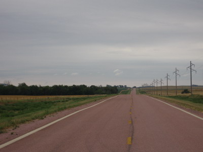
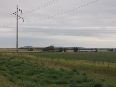
The ride is pleasant for the first few hours. It's a bit strange to be riding bundled up in all my warm gear, after all the 100 degree days I've dealt with in the past weeks. There's no traffic at all on a 30 mile stretch of SD50. This is corn country, and it's not being irrigated. I'm no longer in the really dry high plains.
I try not to dwell on things which are not so good, and over which I have no control.....but the roads in this part of the country, at least the ones I've been riding on, well, THEY SUCK! There, I've said it. The only difference between North and South Dakota roads is the interval between the (bone jarring) cracks. My take is the roads were originally constructed of concrete slabs, and have subsequently been glazed over with layers of tar and gravel. But the geologic faults between the original slabs are still there. In South Dakota the interval between cracks is maybe 50 feet, while to the north the interval was shorter, maybe 30 feet.
The final easting of the day was a ten mile stretch into the town of Platte. This was on a major east-west highway, lots of traffic. The pavement was all broken up, and they had removed the paved portion of the shoulder, replaced it with deep gravel, so there was no place for me to ride except in the travel lane, ruts and potholes and all. By this time it was raining pretty hard, when I got into Platte I was pretty beat & decided to bag it for the day. I ducked into the motel. Tomorrow's another day, and I'm taking a different road out of town.