Gatorade factor: 80 fl oz
The day began with a beautiful ascent of the Coastal Range divide out of
Triangle Lake. Zero traffic on Sunday morning, sunshine and temps in the
60's. The farmers are square baling their hay, leaving bales on the
ground in the field to cure in the low humidity.
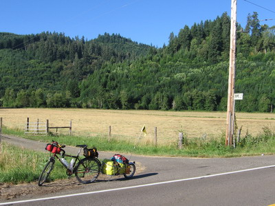
The pass was a little over 1000 feet, only one really steep
grade, then a rolling mixture of evergreen forest and farmland to the
Lawrence Road cutoff. One brief ascent, then miles of downhill into the
Willamette Valley.
It has become apparent that the US Army Corps of Engineers is
alive and well out here, even though they don't have any new dams to
build. Instead they're reconfiguring the old ones. My intended route
had me going along a road that goes across the Fern Ridge dam, west of
Eugene. However, it seems the Corps has it all torn to pieces and
rendered impassable, or at least that's what all the signage says.
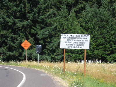
I'm not one to be intimidated by a bunch of signs, I figured
surely I could somehow navigate the dam by bicycle--they obviously
hadn't torn the sucker down because (duh) the lake is still there,
shimmering in the sunlight in all it's glory. Just as it was in the
1970's when it was the site of my first water skiing adventure. So I
rode around the signs and around a bunch of curves down to to dam. And
there was Ranger Rick in his government issue Jeep. My "I'm just a dumb
geologist from Virginia on a bicycle, and I really need to get to
Eugene before they stop serving breakfast" routine did not win the day.
Even though it was obvious that I could ride across the dam without
hurting it or myself. Off I went on a ten mile detour. Skinner's Butte
was always out there in the distance, I just couldn't get to it.
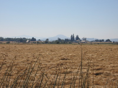
Eventually I successfully wended my way through the valley
farm country around the dam (the GPS unit is a great thing in these
circumstances), and on to Eugene Skinner's city.
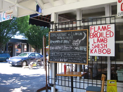
Eugene has grown a lot since I last lived there, but it
doesn't seem to have sprawled a whole lot into the surrounding
countryside. Downtown looks better than ever, with street trees that
have matured, a mix of well-appointed new and older buildings, well
thought out bike lanes everywhere. There are many recreational cyclists
out & about today, both in the city and out in the countryside.
They all give me friendly greetings. I made my way over to a
neighborhood near the university where I used to live, and ate a big
taco salad meal at an outside table amid yawning student folk waking up
from a long night doing what students do on Saturday nights in the
summer.
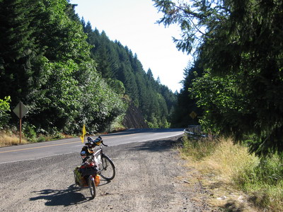
By this time it was about 1pm and getting hot, I decided to
get out of the city and head east on the ACA route up the McKenzie
River & find a place to camp.
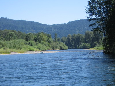
There were about 50 miles on the clock, I figured I could find
some kind of riverside campsite within another 25 or 30 miles. Turned
out the private holdings extend much farther up the river than I had
remembered, and here I am at this beautiful campsite with 103 on the
clock. John Whitaker would say I'm pushing myself too hard. It was
actually not a bad ride, about a 500 foot ascent, mostly along a
spectacular river, spread over 50 miles. I spun most of it in the
middle ring, running 13 or so MPH. BOB takes his toll, but I'm still
able to make reasonable time going down (or up as the case may be) the
road. The traffic was heavy, all weekender RVs, boat trailers and
whatall, but it was all headed back to Eugene on the west bound side of
the road. I could use my whole lane if I wanted to.
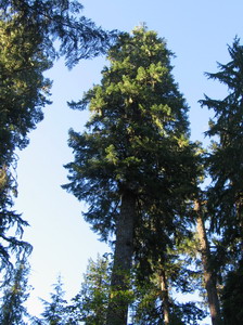
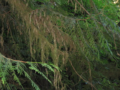
I stopped a couple of times and dunked in the river. And I
stripped down & dunked again when I got here. I just about have the
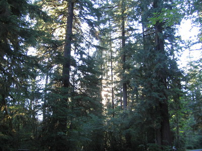
whole place to myself. The fragrance of the evergreen forest is
wonderful. Towering Hemlocks, western Cedar and Douglas Fir with
Spanish moss hanging from the fronds; ferns, Moose Maple and some kind
of Birch understory.
Tomorrow might be a short day on the bike, I'm thinking about
climbing McKenzie Pass (that part won't be short, it's about a 4000
foot ascent from where I am) and camping in the high country. I'll need
to restock with food & water in McKenzie Bridge before I do the
ascent.
There are some very young volcanic rocks up there I'd like to
revisit (no, I'm not bringing any samples home...actually, I believe
there are some chunks of lava from McKenzie Pass in the fireplace in
your bedroom, Jackie, that I brought home on the motorcycle at some
point).
On to rice a la cheddar broccoli chez sardines.
Photo of the day:
