My deep sleep of the pre dawn morning was broken by the sound of diesel irrigation pumps firing up on both sides of the river. In my slumber I thought it was a train going by, then I realized no, this is not Burnley, there is no railroad here. I got it together & cooked breakfast as the sun was rising, got on the road early. The sky was overcast, the Canadian air that has been lingering in the northlands is supposed to push with muscle to the south this afternoon and tonight, big storms are predicted.
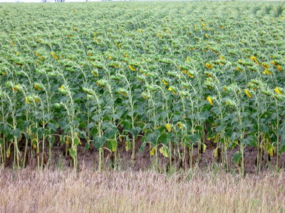
I do a massive climb right off the bat to the top of the mesa, and within a few miles cross into the Crow Creek Indian Reservation. Not noticeably different from the surrounding countryside, people are round baling hay on a massive scale. There's cattle ranching, some wheat and sorghum. Missouri River water sprays from irrigation spiders.
At Stephan the road turns south. The town itself is a half mile or so off the highway, my information says there is no restaurant in Stephen. I keep moving. The town has a recent looking water tower; from a distance, masonry buildings are tightly clustered, a sign points to the Crow Creek Reservation High School. I head for Fort Thompson where I'm thinking there's breakfast to be had.
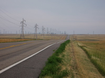
As I ride across the Crow Creek lands, it seems that big electrical lines are converging from all directions, there are towers and lines everywhere. Eventually they all come together at a massive junction station east of the road. I ponder the economic implications for the Crow Creek nation.
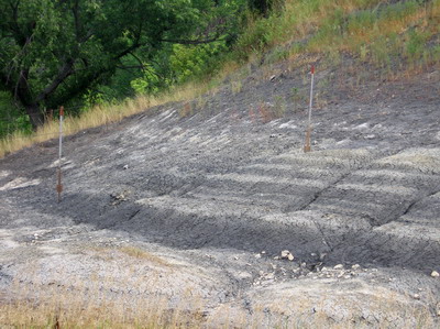 stratified mush in a roadcut....no rocks here
Fort Thompson is the biggest center of population on the Crow Creek Reservation, about 1400 people live there, but the only place that serves breakfast, I am told by a guy who stops to talk without my having to hail him, is the Casino. "But you don't want to go there, go over to the food store across the street, they'll have something for you". He was right, I had no interest in fooling with the Casino, a garish looking building with a parking lot full of expensive looking RV's and pickup trucks. The food store doesn't have much, but the people are nice, and I settled for a couple of slices of pizza.
A bunch of people in "lifestyle" leathers on loud expensive motorcycles headed for Sturgis pull in while I'm eating my pizza. The lady behind the counter looks out at them with a sour expression. I sense she is, as I am, a bit fatigued with with it all. We've both been dealing with hundreds of people living the "Harley lifestyle" for the past week or so. As a veteran motorcyclist myself, I'm sad to report that some of the rudest drivers I've encountered on this trip have been on Harley Davidson motorcycles, usually with straight pipes. These are the ones who make a game out of "buzzing" me. That is, they give me next to no clearance when there's plenty of room for them to move left, and goose the throttle right when they go by so as to make sure I know they're more manly than I am. Have fun, guys.
Pizza eaten, I move on. Even though the clouds are brewing, Fort Thompson is not the place for me to stay tonight, I need to get south of the reservation.
The 27 mile ride over to Chamberlain involves two excursions up to the mesa then back down to river level.
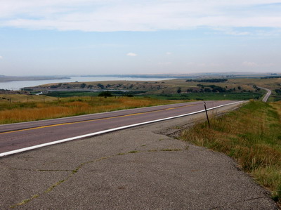 view back on a tough climb
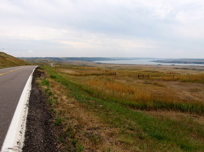 and back down to river level
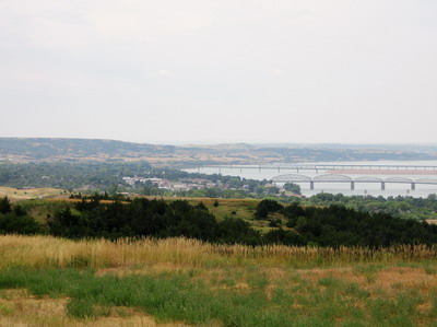 up again & over the bluff to Chamberlain
I haven't quite worked out the cumulative altitude function on the portable massage therapist Michael sent me, but there was probably 3K elevation gain or so over the course of the day. When I arrived in Chamberlain it was still early but I decided to quit for the day rather than ride on and end up in the boonies in stormy weather.
Chamberlain is a nice river town, with a nice campground (duh) on the river. I've spent the afternoon (1) eating buffalo burger etc at a downtown restaurant (2) downloading photos from the camera at a local photo shop (note: I have not yet darkened the doors of WalMart or such on this trip with my presence, instead I've sought out local businesses for non food items, and I have yet to eat in a fast-food chain type restaurant. We'll see if I'm able to maintain this all the way back home.) (3) mailing a package home with the photo CD plus maps I'm done with and a couple of other small things I don't need (eg the camera case, I'm keeping it in one of the two socks--that's one pair-- I brought along. I don't wear socks when I ride, haven't for years, but thought I might want some. I haven't used them yet.) and (4) using the computer at the library to check the web stuff. There were some messages that people had left me on the crayguy guestbook weeks ago.
Folks: I enjoy hearing from people, it helps keep me going, but I don't fool with looking for places to get on the web in these small towns I'm going through. I do download email through pocketmail every 24 hours or so, and I try to respond the next time I dial in. If you'd like to send me a message, I'd enjoy hearing from you. Keep it on the brief side, no attachments, and send it to nickonthebike at gmail dot com.
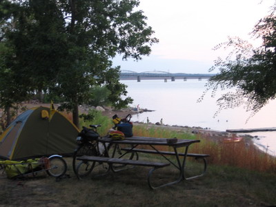
Back at the campground there's a guy named John who's canoeing the Missouri from start to finish. We'll be sharing stories this evening. Talked with Beth, she is doing a great job fielding Virginia Groundwater clients & keeping the home fires burning. It's been a good day.