note: the distances I report are actual miles on the bike for a given day, including whatever side trips happen etc. So these distances usually end up a few miles greater than the true point-to-point distances.
Today began back at The Shack restaurant in Missoula for another order of buckwheat cakes, why mess with a good thing? Then I packed up and went by ACA headquarters one more time to get my rig photographed for the archives. I chatted with the map making folks & offered to help with revisions to some of the maps after I complete my trip. I really like what this organization does.
West bound cyclist Abbott, who's ridden in from Lake Wobegon on his way to Oregon, came by. We had spent some time together yesterday, and we visited some more. He assured me that riding across North Dakota and eastern Montana was full of visual and other sensory stimulation, that the weather was generally cool and dry, there were no bugs, and the winds are always favorable, no matter which direction you happen to be going in.
I assured him that it was all down hill to the Pacific Ocean once you get to the top of Lolo Pass. So I guess we'll both just cruise in to the finish.
I finally managed to extricate myself from Missoula mid morning, and head east up the Blackfoot River on Rt 200. It's been a partly cloudy day, not really hot, and my old friend the afternoon westerlies came through to the tune of about 20mph. I steamed up here to Lincoln, pulling grades that ought to have bogged me down at 15, 17, 18mph. Maybe there's something to this rest day business.
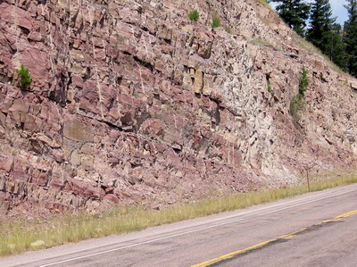
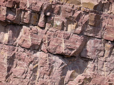
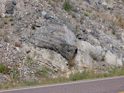
The rocks change east of Missoula to a folded Appalachian-like sequence of red sandstones & shales, and carbonate rocks--Fred Read has probably been here, there are some great roadcuts.
Weed control seems to be somehow on the political road map (no, this doesn't have to do with controlling Al Weed, which would probably be a non-starter (Al's a recent Democratic congressional candidate in central Virginia)) ....it appears there are local weed control boards, perhaps similar to Soil & Water Conservation District boards in Virginia (one of which I serve on as an elected Director). I will attempt to provide photo documentation and clarification of this phenomenon down the road.
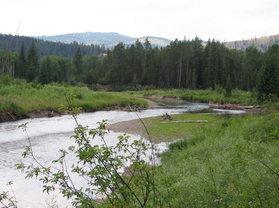
There have been efforts to preserve wetlands on the upper reaches of the Blackfoot River, not sure who is responsible. I rode by a major wetland restoration project but could not stop safely due to narrow road with guardrail. This road has a lot of traffic, and the shoulders are sometimes there, sometimes not. The drivers, though, have so far been very considerate. I use my mirror & bail into the bush if I have to--not fun with the trailer.
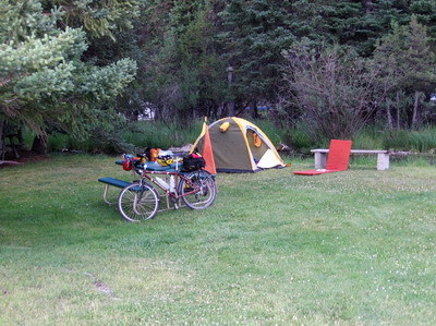
Pulling up hill into Lincoln, I swing left to check out Spring Creek RV Park. The ACA map says there is camping at the town park, but it's Friday night, and I'd prefer a more secure arrangement. Spring Creek turns out to be a great place to camp. If you're a cyclist, for which I think I qualify at this point in my career, six bucks gets you a tent site with table right next to the creek (which it turns out is colder than the Lochsa River), and there's a clean new bath/shower facility. Suits me. There are two women here on mountain bikes with panniers doing the ACA Great Divide trail, they expect to finish in October. Maybe we'll eat breakfast together tomorrow.
As for tomorrow, first of all I need to go over the continental divide, which will involve another 1000 or so feet of climbing from where I'm camped. I'll eat a bunch of caloric stuff at breakfast. Then I'm going to get close to Great Falls. There's a hostel right in town, not sure whether I'll make it all that way, or camp west of town.